OK, so from the BOL...
City #1: 11,000 population, 35 miles away.
City #2: 15,000 population, 45 miles away.
City #3: 500,000 metro area population, 85 miles away.
Highway coming from them is 10 miles away.
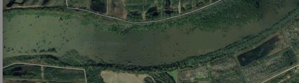
BOL is 1.5 miles by dirt/gravel roads from the nearest public road, and not visible. 1st 1/2 mile is a private farm road, next 1/2 mile is catfish pond levees (catfish ponds are abandoned and overgrown). Last 1/2 mile is a dirt road through the woods that is not visible on Google Maps.
But the analysis breaks down because natural barriers like this will completely prevent people coming in a straight line from the cities, from the highway, and from the public road.
Instead of spreading out in a circle, they will have to be funneled down the highway from the cities, with
MANY choke points along the way - on the main highway, county road, and private roads. Does
Thermopylae ring a bell? One of those choke points on the county road is named "Deadman Lake" LOL.
I would estimate that 90% of the people living between the BOL and the cities are armed.
")