Weather in your area?

Homesteading & Country Living Forum

Help Support Homesteading & Country Living Forum:

This site may earn a commission from merchant affiliate links, including eBay, Amazon, and others.
Can you believe , it's the end of October, the leaves still are not turning colors much.
Must been the drought.
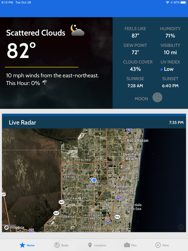
,cuz we are a fixing to need an ark.
3"-6" rain predicted.
We weren't about to let you have all the fun playing in the rain so we ordered us up a little something special:D:
1021191501B_e.jpg


We're the little blue spot:eek:.
 
Last edited:
We weren't about to let you have all the fun playing in the rain so we ordered us up a little something special:D:

We're the little blue spot:eek:.

Only 300 miles across... It's still a baby storm... You guys should fire up the grill by supper time Saturday. ;)
 
Only 300 miles across... It's still a baby storm... You guys should fire up the grill by supper time Saturday. ;)
Yeah, it's just a "practice" storm. Just enough to get people to top-off their generator gas supply that has been running the lawnmower for months:rolleyes:.
{note to self: buy beer}:D
 
didn't get a drop of rain off olga
Mississippi outbid us for it. Looks like they got their nickel's worth:
OlgaPath.JPG

TWC said:
"A museum housing a collection of classic cars valued at $6 million, including a Lincoln once owned by Elvis Presley, was also heavily damaged by the winds in Tupelo.
Olga has dissipated but remnants are pushing north into Tennessee," Moore said.
On Saturday evening, the Tennessee Highway Patrol said strong winds caused about seven semi-trailer trucks to overturn on Interstate 40 in western Tennessee. The highway was closed for a few hours before reopening.
More than 46,000 customers remained without power in Mississippi, while 40,000 outages were reported in Tennessee.
 
Weather man was wrong yesterday, said rains would start just after lunch. They started at midnight last night. I got a couple of small showers then nothing.

It started again about 6 this morning. I've gotten 3 inches since then... Still coming down.

This is the closest I get to fall colors this far south, a couple of maples...

Bottom left 2nd photo on a pressure treated wooden stand... my NWS approved rain gauge recommended by @Bacpacker It will measure down to 1/100 of an inch. I like measuring to that precision.


P f box (2)_v1.jpg
P front (2)_v2.jpg
 
Many school districts and businesses are closed today due to snow and cold temperatures. Some were closed yesterday, and closed early de to the storm. These are the snow totals for the past 2 days in Colorado. We had snow over the weekend as well. Temperatures were in the single digits this morning. Edit: Denver was 3 degrees this morning.

https://www.thedenverchannel.com/news/local-news/colorado-snow-totals-for-oct-29-30-2019-snowstorm

DENVER – We saw snow throughout the day Tuesday and into Wednesday morning, but it finally tapered off Wednesday morning after about four straight days of storms.

Here’s a look at snow totals reported between 11 p.m. Tuesday and 11 a.m. Wednesday. Totals via the National Weather Service are current as of 11 a.m. Wednesday.

9 NE Ponderosa Park – 12 inches
2 W Florence – 11 inches
2 E Parker – 10 inches
4 ESE Foxfield – 10 inches
3 NNE Cherry Creek Reservoir – 8.5 inches
5 WSW Walsenburg – 8 inches
Denver International Airport – 7.7 inches
3 WNW Arapahoe Park – 7.7 inches
3 N Foxfield – 7.2 inches
1 SW Westminster – 7 inches
2 SSW Wetmore – 7 inches
7 ESE Texas Creek – 6.9 inches
1 S Evergreen – 6.8 inches
2 NE Thornton – 6.7 inches
4 NW Ridgway – 6.7 inches
2 SW Rocky Flats – 6.5 inches
1 SW Centennial – 6.4 inches
3 ESE Gypsum – 6.3 inches
2 ESE Federal Heights – 6 inches
1 NNW Security – 6 inches
1 NW Ponderosa Park – 6 inches
3 NNW Sheridan – 6 inches
5 W Westcliffe – 6 inches
Ouray – 6 inches
4 W Ridgway – 6 inches
3 N Skyway – 6 inches
1 ENE Westminster – 5.9 inches
1 S Greeley – 5.7 inches
3 NW Arvada – 5.6 inches
2 NW Frederick – 5.5 inches
1 WNW La Juta – 5.5 inches
1 SSE Eulah – 5.5 inches
1 WSW Rosita – 5.5 inches
3 WNW Ridgway – 5.5 inches
2 N Longmont – 5.1 inches
3 SSW Boulder – 5.1 inches
1 W Edwards – 5.1 inches
2 SE Penrose – 5 inches
2 NNE Monument – 5 inches
2 S Denver – 5 inches
Littleton – 5 inches
2 Estes Park – 5 inches
1 SW Pitkin – 5 inches
4 NNW Mount Crested Butte – 5 inches
1 NW Broomfield – 4.9 inches
2 NE Leadville – 4.9 inches
Maysville – 4.9 inches
3 SW Fort Collins – 4.8 inches
1 E Greeley – 4.5 inches
1 NNE Mountain View – 4.5 inches
7 NW San Isabel – 4.5 inches
3 S Castle Pines – 4.4 inches
2 E Idalia – 4.3 inches
2 N Fort Collins – 4.3 inches
1 NNW Louisville – 4.3 inches
2 NE Pleasant View – 4.3 inches
2 N Aspen Park – 3.7 inches
6 SW Black Forest – 3.5 inches
1 WNW Cheyenne Wells – 3.5 inches
2 ENE Poncha Springs – 3.5 inches
2 SSE Paonia – 3.5 inches
2 ENE Vail – 3.4 inches
1 ESE Steamboat Springs – 3.3 inches
1 NW Eagle – 3.3 inches
3 E Plateau City – 3.2 inches
1 NNW Joes – 3 inches
Yuma – 3 inches
3 N Shaffers Crossing – 3 inches
Oak Vail – 2.9 inches
Burlington – 2.7 inches
1 NE Evergreen – 2.6 inches
Cheyenne Wells – 2.5 inches
2 N Wolcott – 2.4 inches
3 NNW Lazear – 2.3 inches
4 E Cattle Creek – 2.3 inches
4 N Florissant – 2.2 inches
4 NE Phippsburg – 2.2 inches
7 ENE Montrose – 2.2 inches
Carbondale – 2.2 inches
3 ENE Manitou Springs – 2 inches
Burlington – 2 inches
Gypsum 2S – 2 inches
3 NW Lazear – 2inches
Telluride – 2 inches
Montrose 15W – 2 inches
7 NE Purcell – 1.7 inches
2 NW Colorado Springs – 1.5 inches
2 E Montrose – 1.2 inches
1 E Cedaredge – 1.1 inches
4 NNE Wray – 1 inch
Cimarron 8NW – 1 inch
10 NNE Kit Carson. – 0.2 inches
 
Last edited:
Many school districts and businesses are closed today due to snow and cold temperatures. Some were closed yesterday, and closed early de to the storm. These are the snow totals for the past 2 days in Colorado. We had snow over the weekend as well. Temperatures were in the single digits this morning.https://www.thedenverchannel.com/news/local-news/colorado-snow-totals-for-oct-29-30-2019-snowstorm
@DENVER – We saw snow throughout the day Tuesday and into Wednesday morning, but it finally tapered off Wednesday morning after about four straight days of storms.

Here’s a look at snow totals reported between 11 p.m. Tuesday and 11 a.m. Wednesday. Totals via the National Weather Service are current as of 11 a.m. Wednesday.

9 NE Ponderosa Park – 12 inches
2 W Florence – 11 inches
2 E Parker – 10 inches
4 ESE Foxfield – 10 inches
3 NNE Cherry Creek Reservoir – 8.5 inches
5 WSW Walsenburg – 8 inches
Denver International Airport – 7.7 inches
3 WNW Arapahoe Park – 7.7 inches
3 N Foxfield – 7.2 inches
1 SW Westminster – 7 inches
2 SSW Wetmore – 7 inches
7 ESE Texas Creek – 6.9 inches
1 S Evergreen – 6.8 inches
2 NE Thornton – 6.7 inches
4 NW Ridgway – 6.7 inches
2 SW Rocky Flats – 6.5 inches
1 SW Centennial – 6.4 inches
3 ESE Gypsum – 6.3 inches
2 ESE Federal Heights – 6 inches
1 NNW Security – 6 inches
1 NW Ponderosa Park – 6 inches
3 NNW Sheridan – 6 inches
5 W Westcliffe – 6 inches
Ouray – 6 inches
4 W Ridgway – 6 inches
3 N Skyway – 6 inches
1 ENE Westminster – 5.9 inches
1 S Greeley – 5.7 inches
3 NW Arvada – 5.6 inches
2 NW Frederick – 5.5 inches
1 WNW La Juta – 5.5 inches
1 SSE Eulah – 5.5 inches
1 WSW Rosita – 5.5 inches
3 WNW Ridgway – 5.5 inches
2 N Longmont – 5.1 inches
3 SSW Boulder – 5.1 inches
1 W Edwards – 5.1 inches
2 SE Penrose – 5 inches
2 NNE Monument – 5 inches
2 S Denver – 5 inches
Littleton – 5 inches
2 Estes Park – 5 inches
1 SW Pitkin – 5 inches
4 NNW Mount Crested Butte – 5 inches
1 NW Broomfield – 4.9 inches
2 NE Leadville – 4.9 inches
Maysville – 4.9 inches
3 SW Fort Collins – 4.8 inches
1 E Greeley – 4.5 inches
1 NNE Mountain View – 4.5 inches
7 NW San Isabel – 4.5 inches
3 S Castle Pines – 4.4 inches
2 E Idalia – 4.3 inches
2 N Fort Collins – 4.3 inches
1 NNW Louisville – 4.3 inches
2 NE Pleasant View – 4.3 inches
2 N Aspen Park – 3.7 inches
6 SW Black Forest – 3.5 inches
1 WNW Cheyenne Wells – 3.5 inches
2 ENE Poncha Springs – 3.5 inches
2 SSE Paonia – 3.5 inches
2 ENE Vail – 3.4 inches
1 ESE Steamboat Springs – 3.3 inches
1 NW Eagle – 3.3 inches
3 E Plateau City – 3.2 inches
1 NNW Joes – 3 inches
Yuma – 3 inches
3 N Shaffers Crossing – 3 inches
Oak Vail – 2.9 inches
Burlington – 2.7 inches
1 NE Evergreen – 2.6 inches
Cheyenne Wells – 2.5 inches
2 N Wolcott – 2.4 inches
3 NNW Lazear – 2.3 inches
4 E Cattle Creek – 2.3 inches
4 N Florissant – 2.2 inches
4 NE Phippsburg – 2.2 inches
7 ENE Montrose – 2.2 inches
Carbondale – 2.2 inches
3 ENE Manitou Springs – 2 inches
Burlington – 2 inches
Gypsum 2S – 2 inches
3 NW Lazear – 2inches
Telluride – 2 inches
Montrose 15W – 2 inches
7 NE Purcell – 1.7 inches
2 NW Colorado Springs – 1.5 inches
2 E Montrose – 1.2 inches
1 E Cedaredge – 1.1 inches
4 NNE Wray – 1 inch
Cimarron 8NW – 1 inch
10 NNE Kit Carson. – 0.2 inches
@Weedygarden , Find someone and snuggle-up.

We'll save a place down here forya'.
Current temp, 80.4F at 6:00PM:).
@camo2460 , You too. I hate cold more than you!:D
 
@Weedygarden , Find someone and snuggle-up.

We'll save a place down here forya'.
Current temp, 80.4F at 6:00PM:).
I just heard and edited my post. Morning temp was 3 degrees. I think the high today was 18 degrees. Really unusual for October, but I think we are going to have a long cold winter.

I took a dog to the dog park this morning. It was still snowing a little, and it was a little chilly, but layers help. (Two pairs of pants and multiple shirts.) I also have some wonderful wool blend socks from Costco, around $18 for 6 pair. One pair of those socks in my Boggs boots. Then a warm jacket, a neck scarf, gloves and a hat. Dogs had so much energy and fun today. They all needed to get out and their humans as well. Took two more dogs out for a walk at 1:00. It was 11 degrees, but the sun was out and snow is melting. Took another dog to a dog park this afternoon, and again, so much energy and fun. It was cold out, but I was warm.
 
We've had over an inch since 6 am this morning. More to come tonight. I read my gauge at 6 when I leave for work. Our high today was at midnight for 71. Lows in the 60's tonight. Temps dropping all day tomorrow to a low near freezing by sunrise Friday. Bouts of heavy rain tomorrow morning and afternoon. Maybe another 2" from that round.

Peanut, glad to see you got a rain gauge. I haven't found a better one yet for the money.
Have you signed up to report you precip totals with CoCoRahs?
 

Latest posts

Back
Top